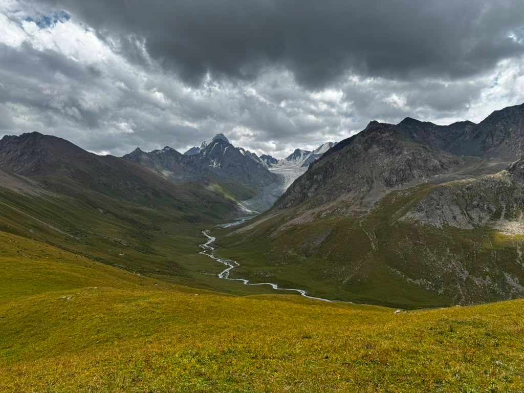
Terskey Alatau, Tian Shan  ·  Kyrgyzstan  ·  4–9 August 2026

The Ak-Suu
Traverse, East

Five passes and sixty-eight kilometres between the Jyrgalan valley and the hot springs at Altyn-Arashan — a group of ten walking, a Kyrgyz crew of guides and horsemen, and the duffels travelling ahead by horse the whole way.

68 kmon foot
5passes
3,671 mhigh point · Ailanysh
5 + 1camps + one yurt
~3,800 mtotal ascent

The profile

Jyrgalan (≈2,260 m) to Altyn-Arashan (≈2,440 m). The red dots are the nights — tap one for the where and how high.

camps  ·  profile reconstructed from itinerary elevations and pass heights, not a GPS trace — see notes

Day by day

Distances and ascents from the operator's route card. Hover a day to light its segment on the profile.

Day 1Aug 4
→ Camp 1 · Jurgalan River

Into the valley

A two-hour drive from Karakol to a village at the head of the Jyrgalan valley, then the first walk: a steady climb beside the river to a camp on its bank, the water loud with snowmelt off the glacier upstream. Off the beaten track immediately, as promised.

9.2 km  ·  +600 m  ·  4–5 hrs

Day 2Aug 5
→ Camp 2 · Tyrgon Valley

Jurgalan Pass · 3,500 m

Up and over the first pass into the Tyrgon Valley — a vast grassy expanse where herds roam free and their shepherds camp in yurts on the valley floor.

13.8 km  ·  +630 m  ·  5–7 hrs

Day 3Aug 6
→ Camp 3 · below Bosuchuk

Tyrgon Pass · 3,500 m

Fully self-sufficient now — guides, horsemen, pack animals, and nothing else. Camp at the base of the next day's climb, deep in country with no light pollution at all.

10 km  ·  +700 m  ·  5–7 hrs

Day 4Aug 7
→ Camp 4 · below Ailanysh

Bosuchuk Pass · 3,400 m

From the top of Bosuchuk a completely new set of mountains opened up. A shorter day on paper and it didn't feel like one — steep on both sides, a river crossing, then a sheltered camp at the bottom of the Ailanysh climb.

8 km  ·  +530 m  ·  5–7 hrs

Day 5Aug 8
→ Camp 5 · below Ortok

Ailanysh Lake & Pass · 3,671 m

Up to a remote freshwater lake clean enough to drink from — we filled bottles straight out of it — then over the highest point of the route. The longest views of the trip from the top, and a descent to camp at the foot of the final pass.

13 km  ·  +500 m  ·  6–7 hrs

Day 6Aug 9
→ Altyn-Arashan

Ortok Pass · 3,609 m

The biggest day saved for last: 840 metres up over Ortok with a glacier in view, then a long knee-testing descent into the Altyn-Arashan valley — "Golden Spring" — where a nomad's yurt, natural hot springs, and purchasable beer were waiting in exactly that order of importance.

14 km  ·  +840 m  ·  6–7 hrs

DayDateStagePassDistAscentHours
1Aug 4Village → Jurgalan River camp9.2 km+600 m4–5
2Aug 5→ Tyrgon ValleyJurgalan · 3,500 m13.8 km+630 m5–7
3Aug 6→ base of BosuchukTyrgon · 3,500 m10 km+700 m5–7
4Aug 7→ base of AilanyshBosuchuk · 3,400 m8 km+530 m5–7
5Aug 8Ailanysh Lake → base of OrtokAilanysh · 3,671 m13 km+500 m6–7
6Aug 9→ Altyn-ArashanOrtok · 3,609 m14 km+840 m6–7

Notes on the data

Distances, ascents, and pass heights are from the operator's route card for this itinerary; the six-day total of 68 km agrees closely with the 43.3 miles recorded on a groupmate's Garmin over the same days. The elevation profile above is a reconstruction drawn through the known camp and pass elevations — it is honest about shape and height, but it is not a GPS trace, and the slopes between points are schematic.

The route is the eastern half of the full Ak-Suu Traverse, which continues from Altyn-Arashan over the Ala-Kul Pass (3,860 m+) to Jeti-Öguz — roughly 100 km and seven passes in all. That western half remains unhiked. For now.

With thanks to Kevin Williams — for the Garmin record that anchors these numbers, and for the inspiration to make this page.